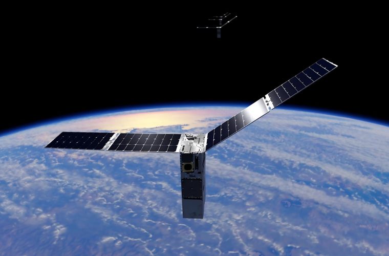
The UK Space Agency has allocated £2.5 million to five engineering projects that demonstrate how satellite data processing systems can enhance public service delivery across infrastructure monitoring, environmental analytics, and agricultural support applications.
The funding, announced at the European Space Agency’s Living Planet Symposium 2025, supports projects that integrate satellite-derived data with ground-based systems to create actionable intelligence for government agencies and local authorities.

Geospatial Ventures in Nottingham is developing an infrastructure monitoring system that processes synthetic aperture radar (SAR) data to detect millimetre-scale structural movements in buildings and bridges. The system combines radar interferometry with machine learning algorithms to identify potential safety issues before they escalate into critical situations.
The technology addresses the challenge of monitoring large-scale infrastructure networks, where manual inspection is both costly and potentially hazardous. By processing continuous satellite data streams, the system can track structural changes across multiple sites simultaneously, providing early warning capabilities for maintenance teams.
GHGSat UK’s advanced analytics platform processes spectral data from its satellite constellation to identify and quantify methane emissions from industrial facilities. The system utilises hyperspectral imaging, combined with atmospheric modelling, to trace emission sources with precise geographic attribution.
If the mission succeeds, the platform will provide government agencies with emission data within hours of detection, supporting accountability measures and targeted mitigation strategies. The technology focuses on methane detection due to its high global warming potential and the technical feasibility of space-based detection at industrial scales.
AAC Clyde Space in Glasgow is creating a biodiversity assessment tool that processes high-resolution multispectral imagery from their satellite constellation. The system uses spectral analysis to identify plant species and habitat types, providing farmers with detailed ecological mapping of their land.
The technology supports sustainable farming initiatives by enabling precise habitat identification and mapping of wildlife corridors. This data integration helps farmers access government support schemes while maintaining biodiversity objectives.
Earth-i in Guildford is developing environmental monitoring indicators that process satellite imagery to track land use changes and agricultural practices. The system provides automated analysis for the Rural Payments Agency, supporting subsidy verification and environmental compliance monitoring.
HR Wallingford’s biodiversity tracking project uses Earth observation data to monitor habitat changes over time, supporting the UK’s biodiversity net gain requirements. The system processes temporal satellite data to quantify ecological improvements and assess progress in habitat restoration.
Engineering Deep Dive: Satellite Data Processing Systems
Modern satellite data processing systems represent a convergence of multiple engineering disciplines, combining aerospace systems, signal processing, and data analytics to extract actionable information from orbital platforms.
Contemporary Earth observation satellites operate in low Earth orbit (LEO) at altitudes ranging from 400 to 800 kilometres, providing global coverage through constellation arrangements. These systems typically employ either optical sensors for visual spectrum imaging or synthetic aperture radar (SAR) for all-weather monitoring capabilities.
Optical sensors capture electromagnetic radiation in visible and near-infrared wavelengths, using charged-coupled device (CCD) or complementary metal-oxide-semiconductor (CMOS) arrays. Hyperspectral sensors extend this capability across hundreds of narrow spectral bands, enabling material identification through unique spectral signatures.
SAR systems transmit microwave pulses and process reflected signals to create high-resolution images regardless of weather conditions. The synthetic aperture technique utilises satellite motion to simulate a larger antenna, achieving spatial resolutions comparable to those of optical systems while maintaining all-weather operational capability.
Raw satellite data requires extensive processing before it becomes useful for applications. The processing pipeline begins with radiometric calibration, where sensor response variations are corrected using pre-launch calibration data and onboard reference sources.
Geometric correction follows, transforming sensor coordinates to Earth-based coordinate systems. This process requires precise knowledge of satellite position and attitude, typically derived from GPS receivers and inertial measurement units. Ground control points provide additional accuracy for precise georeferencing.
Atmospheric correction represents a critical processing step, particularly for optical sensors, as atmospheric gases and aerosols impact signal propagation, resulting in systematic errors in surface reflectance measurements. Advanced algorithms utilise atmospheric modelling and sensor data to estimate and mitigate these effects.
Modern satellite data processing increasingly relies on machine learning techniques to extract meaningful information from complex datasets. Convolutional neural networks (CNNs) excel at pattern recognition in imagery, enabling automated feature detection and classification.
Deep learning models require extensive training datasets, typically created through manual annotation of satellite imagery. Transfer learning techniques enable models trained on one geographic region to be adapted for use in different areas, thereby reducing the computational requirements for new applications.
Synthetic aperture radar processing involves sophisticated signal processing algorithms to create focused imagery from raw radar returns. Range compression utilises matched filtering to enhance range resolution, while azimuth compression leverages Doppler frequency shifts to achieve acceptable cross-track resolution.
Interferometric SAR (InSAR) processing compares phase information from multiple radar acquisitions to detect surface deformation with millimetre precision. This technique requires careful phase unwrapping algorithms to convert relative phase measurements into absolute displacement values.
Multi-sensor data fusion combines information from different satellite platforms to create comprehensive datasets. This process requires the temporal and spatial registration of datasets with varying acquisition characteristics and resolutions.
Statistical analysis techniques extract trends and patterns from time-series satellite data. Change detection algorithms identify significant variations in surface conditions, while classification methods categorise land cover types based on spectral signatures.
Satellite data distribution systems must handle massive data volumes while maintaining low latency for time-sensitive applications. Cloud-based processing platforms enable scalable data processing, while edge computing reduces latency for critical applications.
Data compression techniques reduce transmission bandwidth requirements while preserving essential information content. Lossy compression methods trade data fidelity for reduced file sizes, while lossless compression maintains perfect data integrity.
Integrating satellite data processing systems with existing infrastructure requires careful consideration of data formats, communication protocols, and processing capabilities. Application programming interfaces (APIs) provide standardised access to processed data, while metadata standards ensure interoperability between different systems.
Real-time processing requirements necessitate high-performance computing systems that can handle continuous data streams. Distributed processing architectures enable scalable solutions that can adapt to varying data volumes and processing requirements.
The engineering challenge extends beyond data processing to system integration with existing government infrastructure. Each project must develop APIs and data formats that are compatible with current public sector systems while maintaining data security and privacy requirements.
Processing latency remains a critical factor for time-sensitive applications, such as emission monitoring and infrastructure safety. Cloud-based processing platforms offer scalability advantages but require careful bandwidth management for large datasets from satellites.
If these pilot projects demonstrate operational viability, they could establish frameworks for broader deployment across UK public services. The integration of satellite data processing with existing government systems represents a significant step toward delivering space-enabled public services.
The projects address specific technical challenges in translating raw satellite data into actionable intelligence for non-technical end users. Success will depend on system reliability, data accuracy, and the effectiveness of integration with existing operational workflows.
The UK Space Agency’s investment reflects a growing recognition that satellite technology can address practical challenges in public service delivery, from infrastructure maintenance to environmental monitoring. These engineering applications demonstrate how space-based systems can enhance ground-based operations through continuous, wide-area monitoring capabilities.