GPS-Free Satellite Navigation: NASA’s FALCON Finds Its Way by Starlight
NASA's Starling mission demonstrated GPS-free satellite navigation by using other spacecraft and orbital debris as reference points, a first for optical space navigation.
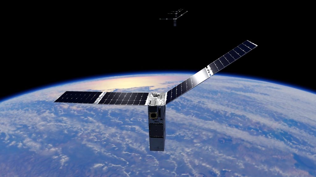
Sailors used to navigate using the stars and this method was effective for crossing oceans, for discovering continents and for fighting naval wars that extended across hemispheres. Nowadays a small number of NASA satellites have carried out something similar in concept, but rather than using Polaris and Sirius they have used other spacecraft and pieces of orbital debris as their guide stars.
The FALCON experiment, which stands for Fast Autonomous Lost-in-space Catalog-based Optical Navigation, was part of NASA’s four-satellite Starling mission[1]. Its objective was straightforward: to demonstrate that a spacecraft is able to find out where it is without using GPS. The results, which were made public in August 2026[2] and were described by SciTechDaily, went beyond what the team had expected.
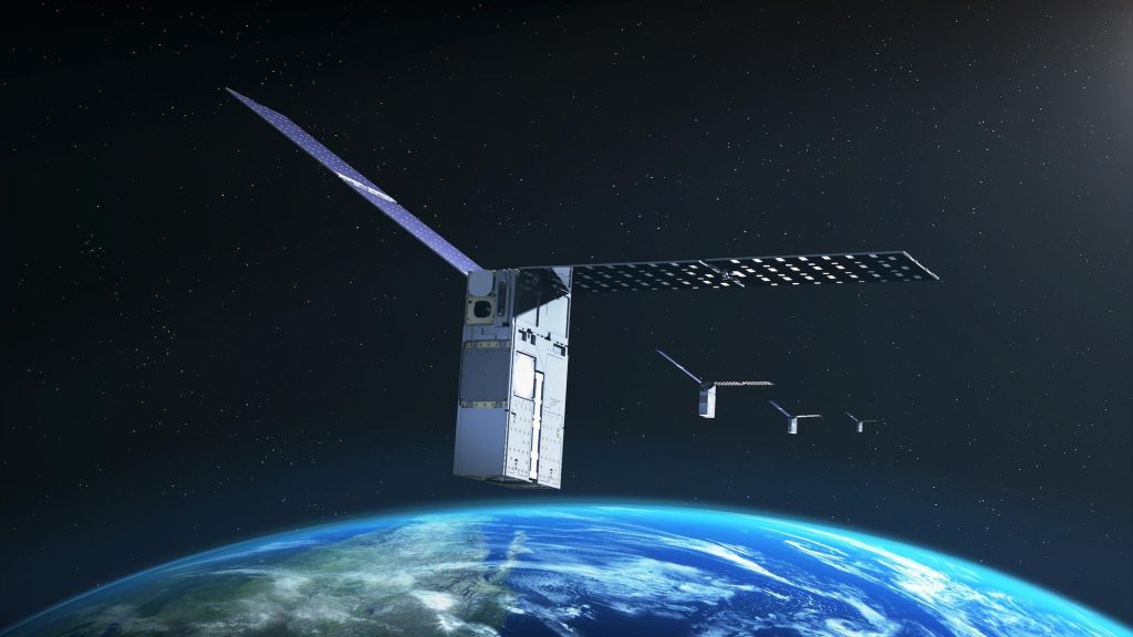
FALCON made use of the star-tracker cameras which Starling already had, cameras that are normally employed to establish the orientation of the spacecraft by recognizing bright stars[3]. The team included in the on-board catalogue about 20,000 space objects, such as satellites, rocket bodies and fragments of debris, together with predictions of the objects’ orbits[4]. Whenever the cameras detected objects that were drifting, FALCON compared them with the catalogue and used the known positions of the objects to determine Starling’s location.
It succeeded; during three days of working autonomously, FALCON was able to determine Starling’s orbit without the use of GPS and improved the predicted positions of over 200 other objects[5]. The new orbits were more accurate than the data from the ground-based catalogue that the system had initially used[6].
Why GPS-Free Satellite Navigation Matters Beyond Earth Orbit
GPS is available all around the Earth, with thirty-one satellites sending out timing signals that enable any receiver to determine its position to within a few metres. However, Mars is far beyond the reach of GPS.
When NASA and the other agencies are planning their way towards establishing a permanent presence on the Moon, carrying out Artemis missions to the surface and eventually sending crews to Mars, the problem of how spacecraft can navigate in the absence of GPS arises. FALCON provides one possible solution: to use the space environment as a means of navigation. “The number of ‘firsts’ from Starling just keeps growing,” stated Roger Hunter, NASA’s programme manager for small spacecraft at the Ames Research Center[7].
FALCON is a project that involves collaboration between NASA and EraDrive, a company which has been established from Stanford University[8]. EraDrive is bringing to market the Era-Core flight software which forms the basis of the system, with the intention of offering GPS-free satellite navigation as a service to commercial satellite operators and to government agencies. Later this year, Starling’s four spacecraft are going to test a cooperative mode in which the satellites will share their tracking data in order to improve their individual positions[1]. For students taking A-level Physics or Further Maths, the fundamental principles concern vectors, trigonometry and orbital mechanics. The method of triangulation from known reference points is the same geometric technique used in land surveying, with the difference that it is applied in three dimensions and is made more complex by the fact that both the observer and the reference points are in motion.
Engineering deep dive
How GPS-Free Satellite Navigation Works
The FALCON system is based on a area of mathematics known as orbit determination. All objects in Earth orbit move along a path which is influenced by gravity, atmospheric drag in the case of low orbits, solar radiation pressure and gravitational disturbances caused by the Moon and the Sun. If you know an object's position and velocity at a particular moment, you can use Newtonian mechanics - the same equations of motion as those studied at A-level Physics - to predict its future path.
Ground-based radar stations carry out this procedure regularly. They keep track of thousands of objects, work out their orbital elements - the six figures which uniquely define an orbit - and produce catalogues that predict where each object will be at any future time. The predictions gradually move away from actuality as the effect of small unmodelled forces builds up, which is why it is necessary to provide frequent updates.
FALCON reverses the process. Rather than a ground station monitoring objects in order to calculate their orbits, it is a spacecraft that observes these objects in order to find its own orbit. The logic is identical: if you know the positions of the reference objects from the catalogue and take the angles between your line of sight and several of them, you can calculate your own position. This is based on the same principle as GPS, except that it uses optical bearings rather than radio time-of-arrival measurements and catalogued space objects instead of dedicated navigation satellites.
The star-tracker cameras aboard Starling were constructed to measure the positions of the stars with an accuracy of less than one arcsecond. Since stars are effectively at an infinite distance, their angular positions do not alter as the spacecraft travels around its orbit. In contrast, other objects in low Earth orbit are close enough for their apparent positions to change noticeably as Starling moves. This parallax, which is the apparent shift in position caused by a change in the observer's point of view, is precisely the information that FALCON requires. Students studying at A-level Maths might identify this as an example of trigonometric parallax - the same method that astronomers use to determine the distances to nearby stars - although in this case it is being applied to much nearer objects for a different purpose.
Matching entries in the catalogue is a computationally intensive process. At any given time the Starling cameras could be observing dozens of objects and the system has to work out which catalogue object each one corresponds to, taking into account errors in the predicted positions. FALCON makes use of a probabilistic matching algorithm which takes into consideration position, brightness, the speed at which objects move across the field of view, and the general pattern of the objects visible in the same frame. The software, which was developed by EraDrive, operates completely on board the spacecraft with no contact being made with the ground.
The ability to improve orbits is achieved as a result of the navigation process. If FALCON matches an observed object with an entry in the catalogue but discovers that the observation does not agree with the prediction, it adjusts the predicted orbit so that it better fits the observation. As a result of many such observations, the corrections build up and the entry in the catalogue becomes more accurate. In three days FALCON enhanced more than 200 orbits, a result which usually demands ground-based radar time.
The further cooperative extension in 2026 involves yet another aspect: by having the four Starling satellites share their observations, the total dataset includes more lines of sight to each object and thus reduces the uncertainty about its position. It's similar to the way human binocular vision provides depth perception whereas monocular vision does not - two viewpoints are better than one and four are even better.
Falcon hasn't still reached the stage of being able to take over from GPS in operational missions since its accuracy is worse than that of GPS and the system depends on a catalogue which has to be kept and updated. However, it does provide a means for missions outside the area where GPS is available or when it is necessary to have a backup because GPS signals are jammed or degraded, the method involving the use of space objects as references being one that didn't exist before this demonstration. The next phase will be a cooperative test in which the Starling swarm will navigate as a formation, each satellite assisting the others in finding their way.
Links to the curriculum: A level
FALCON has not yet reached the stage of being able to take over from GPS in operational missions since its accuracy is worse than that of GPS and the system depends on a catalogue which has to be kept and updated. However, it does provide a means for missions outside the area where GPS is available or when it is necessary to have a backup because GPS signals are jammed or degraded, the method involving the use of space objects as references being one that didn’t exist before this demonstration. The next phase will be a cooperative test in which the Starling swarm will navigate as a formation, each satellite assisting the others in finding their way.
Sources
8 sources
NASA’s Starling Mission Opens New Frontiers in Space Navigation
Later this year, Starling, which launched in 2023, will extend the FALCON experiment using Era-Core, enabling its four-spacecraft swarm to share tracking data and refine their positions collectively.
Checked 14 October 2026
NASA’s Starling Mission Opens New Frontiers in Space Navigation
The FALCON (Fast Autonomous Lost-in-space Catalog-based Optical Navigation) technology demonstration is a step toward spacecraft being able to operate more independently.
Checked 14 October 2026
NASA’s Starling Mission Opens New Frontiers in Space Navigation
The FALCON demonstration tested two complementary capabilities that made creative use of Starling’s onboard star-tracker cameras, standard instruments that identify bright objects in space to inform a spacecraft’s orientation and position.
Checked 14 October 2026
NASA’s Starling Mission Opens New Frontiers in Space Navigation
The mission team loaded the full catalog of approximately 20,000 space objects and their predicted orbits onto the spacecraft.
Checked 14 October 2026
NASA’s Starling Mission Opens New Frontiers in Space Navigation
During a three-day period, FALCON improved the known orbits of more than 200 objects without intervention from operators on the ground.
Checked 14 October 2026
NASA’s Starling Mission Opens New Frontiers in Space Navigation
to estimate Starling’s location – and the locations of other space objects – with even greater precision than the current catalog data.
Checked 14 October 2026
NASA’s Starling Mission Opens New Frontiers in Space Navigation
said Roger Hunter, program manager for NASA’s Small Spacecraft and Distributed Systems program at NASA’s Ames Research Center in California’s Silicon Valley. “The number of ‘firsts’ from Starling just keeps growing.”
Checked 14 October 2026
NASA’s Starling Mission Opens New Frontiers in Space Navigation
The FALCON payload is a joint flight experiment by NASA and EraDrive, a startup spun out from Stanford University.
Checked 14 October 2026
Share
Related stories
All Space
Automotive & TransportBreakthroughs
NASA’s Skyfall Mission: Six Autonomous Helicopters Target Mars Resource Mapping by 2028