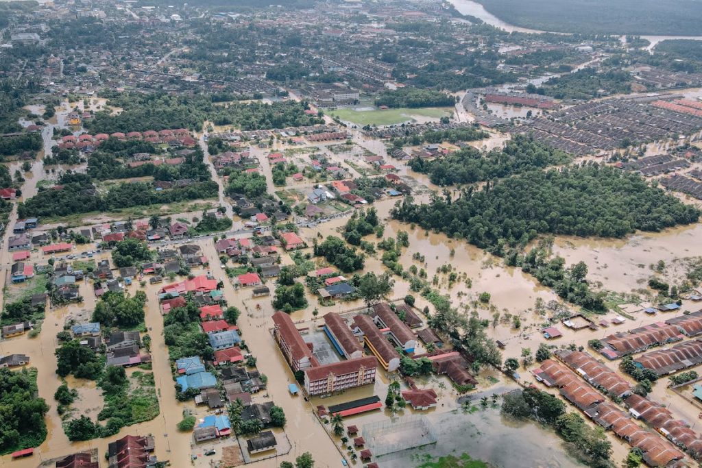
Back in 2021, a band of thunderstorms stalled over parts of London. In less than two hours, some areas received a month’s worth of rain. Floodwater surged through streets, poured into Underground stations, and filled basements across the capital. Two people died. Thousands of homes were damaged. The flooding was not caused by a river bursting its banks or a tidal surge. It was surface water, rain that fell faster than drains, sewers, and the ground itself could absorb it.
Surface water flooding is now one of the highest-rated environmental risks in England. The latest National Flood Risk Assessment shows that approximately 4.6 million properties are at risk from surface water flooding, a 43 per cent increase on previous estimates. Three times as many properties face high risk from surface water as from rivers and the sea combined. Yet until recently, the tools available to forecast these events lagged far behind those used for river and coastal floods.
The Flood Forecasting Centre (FFC), a joint operation between the Met Office and the Environment Agency, has completed a three-year programme called the Surface Water Flood Forecasting Improvement Project (SWFFIP). The project has upgraded the national surface water flood forecasting system from a broad-brush risk assessment into an impact-based forecasting service that tells emergency responders not just where flooding might occur, but what it is likely to damage.
The upgraded system brings together three data streams: surface water runoff forecasts from the national hydrological model, detailed flood maps from the Environment Agency’s risk models, and receptor data that catalogues the location and vulnerability of properties, transport routes, and infrastructure. These inputs are combined on a dashboard that displays flood impact likelihood for each county across four severity levels, from minimal to severe. Forecasters can now assess surface water flood risk up to three days ahead.
For the critical window of zero to six hours before an event, when emergency services need to position equipment and issue warnings, the FFC has trialled new nowcasting tools. These use radar rainfall data blended with model output to produce short-range forecasts of where intense rainfall will hit, and what damage it is likely to cause, with far greater spatial precision than was previously possible.
Climate change is intensifying the problem. Short, intense summer rainfall events are becoming more frequent, and urbanisation means more hard surfaces for rain to run off. Flooding that was once considered a nuisance, a few centimetres of water in a road, is increasingly becoming a threat to life. The SWFFIP programme represents engineering applied to prediction rather than concrete, but the downstream benefits for drainage engineers, highway authorities, and emergency planners are substantial.
Engineering Deep Dive: How Surface Water Flood Forecasting Works
To understand why surface water flooding is so difficult to predict, consider the difference between river flooding and pluvial (rainfall-driven) flooding. River flooding happens when sustained rain over a catchment area causes water levels to rise gradually over hours or days. It follows predictable paths along river channels, and gauging stations provide continuous measurements that feed into well-established hydrological models. Forecasters can often give 24 to 48 hours of warning.
Surface water flooding is different in almost every respect. It is driven by rainfall intensity, not volume. A 20-millimetre downpour spread over 12 hours causes no surface flooding. The same 20 millimetres falling in 30 minutes overwhelms drainage systems. The flooding occurs wherever the rain falls, not along a defined channel, which means it can happen anywhere. The onset is rapid, sometimes within minutes, and the affected area depends on extremely local factors: the slope of a road, the diameter of a drain, the permeability of the soil, the presence of a wall or kerb that traps water.
Modelling this requires a combination of meteorological and hydrological data at high spatial and temporal resolution. The Met Office’s convection-permitting weather models can simulate individual thunderstorm cells, producing rainfall forecasts at 1.5 km resolution. These forecasts feed into the Grid-to-Grid (G2G) hydrological model, which simulates how rain interacts with the land surface across the entire country, accounting for soil moisture, land use, slope, and drainage capacity.
A-level Geography and Physics students will recognise several concepts here. The water cycle, infiltration rates, and surface runoff appear in Geography modules. The physics of fluid flow, pressure, and the behaviour of water in constrained channels connects to mechanics. The statistical concept of return periods, the average interval between flood events of a given severity, underpins the risk assessment framework.
The impact-based approach is what makes the new system different from its predecessor. Rather than issuing a generic warning that surface water flooding is possible in a broad area, the system models specific consequences. It cross-references the predicted flood footprint with a national database of receptors: residential properties, schools, hospitals, railway lines, motorway underpasses, electrical substations. A forecast of 30 mm of rain in an hour means something very different for a hillside village with good natural drainage than it does for a low-lying London borough with Victorian combined sewers already running at capacity.
For civil and drainage engineers, these forecasts have practical applications beyond emergency response. More accurate, location-specific predictions allow more dynamic operation of combined sewer systems. Attenuation basins, designed to temporarily hold excess stormwater, can be pre-emptively lowered ahead of predicted events. Sustainable drainage systems (SuDS), rain gardens, permeable pavements, and swales, can be better designed using calibrated data from the improved models. The forecasting system does not replace physical flood defences, but it makes existing infrastructure work harder.
The nowcasting tools trialled under SWFFIP use a technique called ensemble forecasting. Rather than producing a single predicted outcome, they generate multiple scenarios, each representing a slightly different evolution of the weather system. This gives forecasters a probability range, from the most likely outcome to the worst case, which is more useful for decision-making than a single deterministic forecast.
Surface water flooding will remain a growing risk as climate change increases rainfall intensity and urban areas continue to expand. No forecasting system can prevent flooding. What it can do is buy time, sometimes hours, sometimes only minutes, for the decisions that protect lives and reduce damage. The engineering here is not steel and concrete. It is data, modelling, and the careful assembly of systems that turn raw weather information into actionable intelligence.